Continental Rifting & Flood-Basalt Provinces
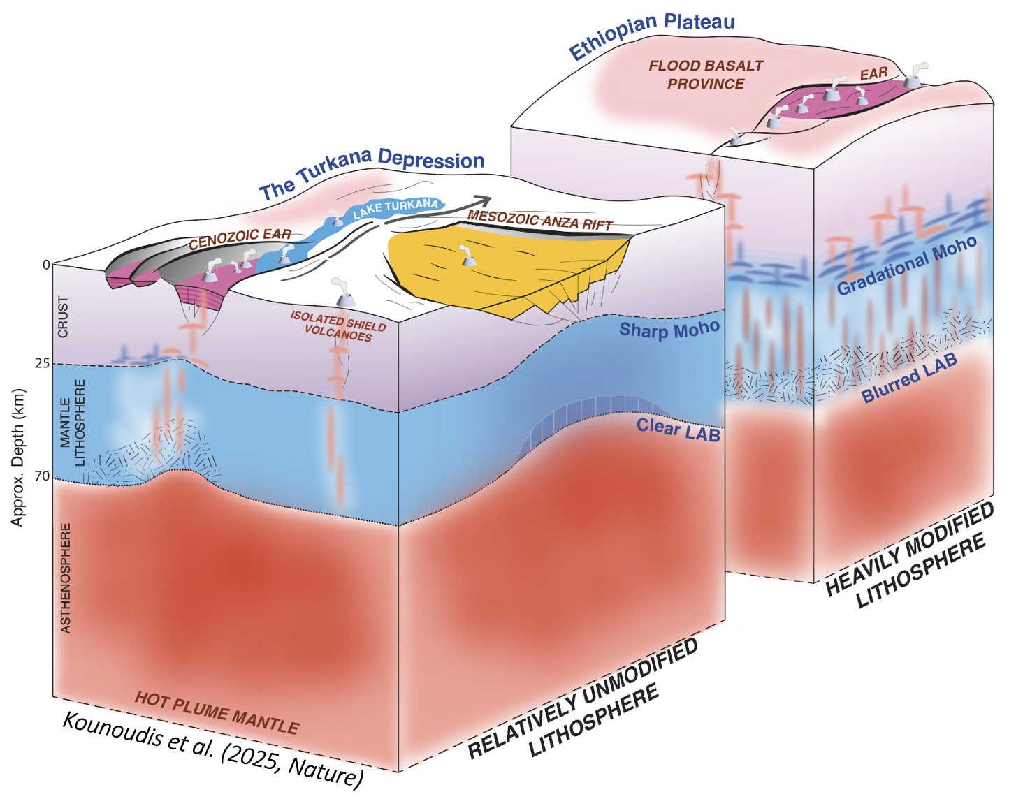
Continental Flood-Basalt Provinces are among the largest volcanic events in Earth's history. They rapidly erupt enormous volumes of magma and often trigger the break-up of continents. Precisely how continental plates rift apart to form new oceans is debated because there are few places on Earth where this process is currently active. One such region is the East African Rift, where narrow rift valleys cut through the uplifted Ethiopian and Kenyan Plateaus. Lithospheric thin zones, such as recently failed rifts, are generally assumed to be weak spots where magmatism and deformation can concentrate during rifting and flood-basalt provice development. However, by probing the lithospheric structure of the Turkana Depression in East Africa, we instead find that areas stretched by past rifting, are actually stronger, not weaker and may thus be more resistant to rifting and magmatism.
Read More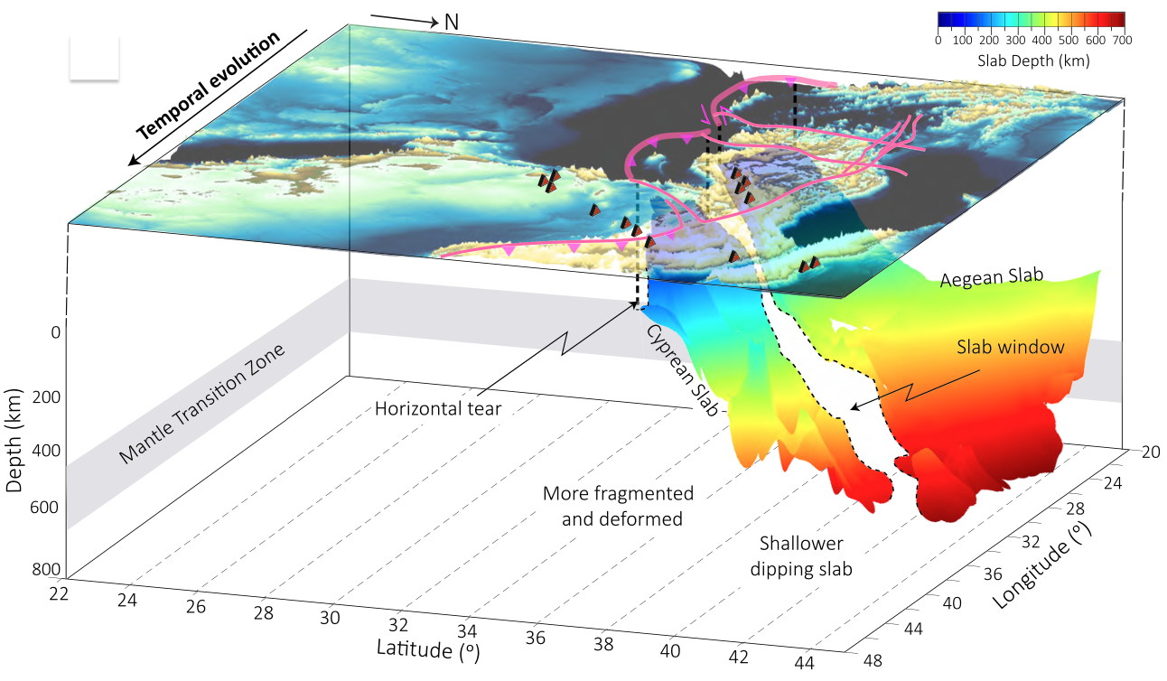
Subduction Zones
Subduction zones are among the most dynamic tectonic settings on Earth, where oceanic lithosphere sinks into the mantle, driving volcanism, uplift and mountain building on the overriding plate. Using seismic tomography I have explored how subducting slabs fragment, and ultimately detach during terminal-stage subduction below the Eastern Mediterranean, providing new insights into slab break-off, lithospheric delamination, and the links between deep Earth processes and surface tectonics. I also invesitaged the influence of a subducting slab on mantle flow beneath Alaska.
Read More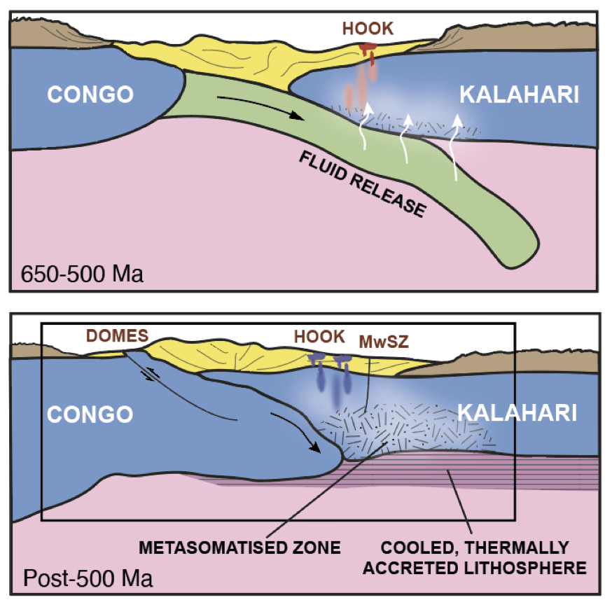
Cratons & Ancient Orogens
Cratons are the ancient and stable cores of continents, preserving a geological record spanning billions of years. The Copper Basin Exploration Science (CuBES) project involved the deployment of a 35-station broadband seismograph netowork across the late Proterozoic-ealy Paleozoic Central African Copperbelt and neighbouring Congo and Kalahari Craton margins. The data was used to image crustal and mantle structure using a variety of seismological techniques to constrain the region's tectonic evolution. I am also currently investigating the lithospheric structure of the Uganda Craton which may have been thermally/magmatically modified by Cenozoic rifting/mantle plume interactions.
Read More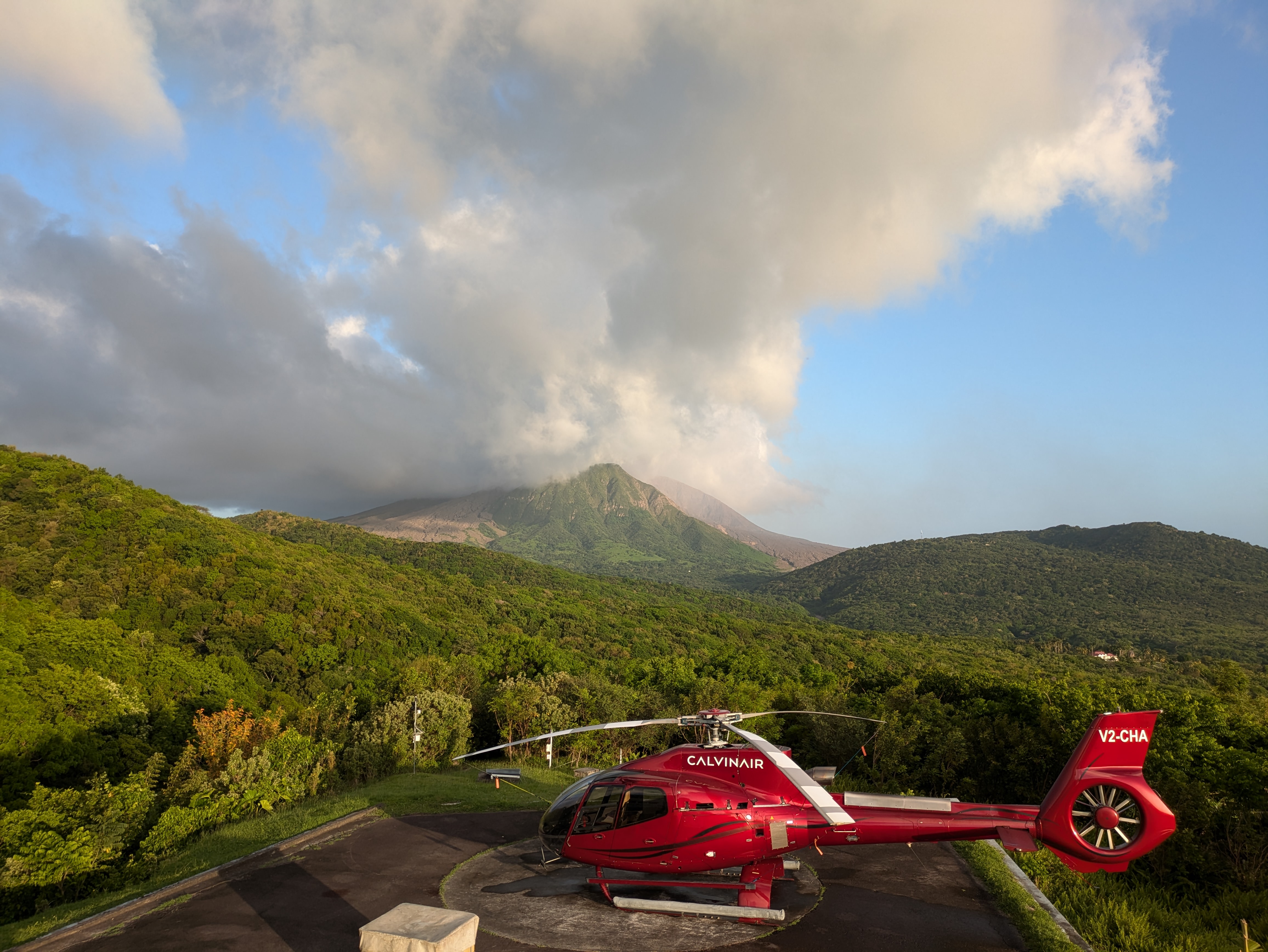
Volcano Seismology
Volcano seismology can provide valuable insights into the movement of magma and hydrothermal fluids beneath active volcanoes. My research uses passive seismic techniques, including modern earthquake detection and imaging techniques to investigate volcanic plumbing systems, magma migration, and crustal deformation below volcanoes in Montserrat and Costa Rica, and improve our understanding of volcanic processes.
Read More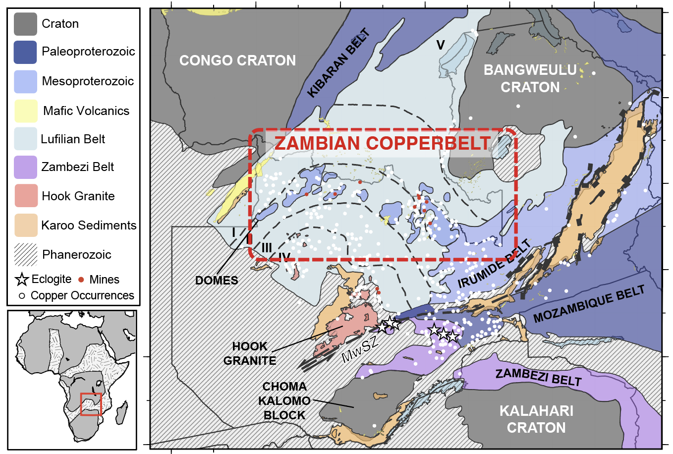
Critical Metals
The global transition to low-carbon technologies depends on reliable supplies of critical metals such as copper, cobalt, nickel, and rare earth elements. Through the Copper Basin Exploration Science (CuBES) experiment, I investigate the lithospheric architecture that underpins the Central African Copperbelt—one of the world's most significant metallogenic provinces, using passive seismological techniques integrated with geological observations and other geophysical techniques.
Read More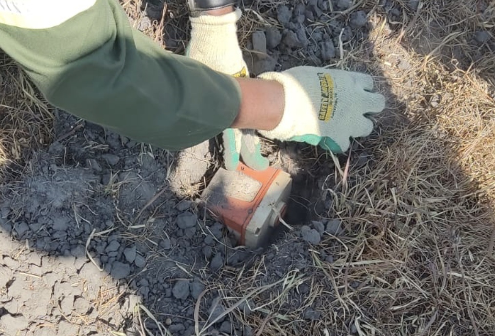
Geothermal Energy
Hydrothermal fluids found in active volcanoes and continental rifts have fantastic potential to provide a reliable source of geothermal power to local communities. In these regions, recordings from seismograph stations reveal earthquake swarms that accompany rock fractures during fluid migration. Monitoring seismicity is thus proven to be a powerful tool for understanding the behaviour of geothermal systems. In Montserrat and one of Zambia's most promising geothermal systems, we have utilized passive seismological deployments, using novel MEMS-based seismic nodes to monitor seismicity, map permeable fracture networks, and characterise the region's tectonic stresses.
Read More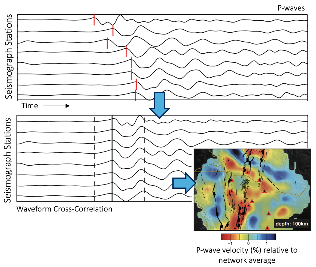
Body-Wave Tomography
Body-waves from distant (teleseismic) earthquakes traverse the deep interior of the Earth en route to a seismograph station and allow imaging of mantle seismic structure via P- and S-wave arrival-time tomography. Given known earthquake-station pairs, travel-times through the Earth can be predicted with remarkable accuracy using 1D reference Earth models. However, seismic energy does not always arrive precisely when expected. The difference between predicted and observed arrival-times—termed arrival-time residuals—reflect the wavespeed structure traversed along earthquake-station paths. Recording these residuals on a collection of earthquake-station pairs across the globe allows for the construction of a 3D model of upper-mantle seismic structure below the seismograph network.
Read More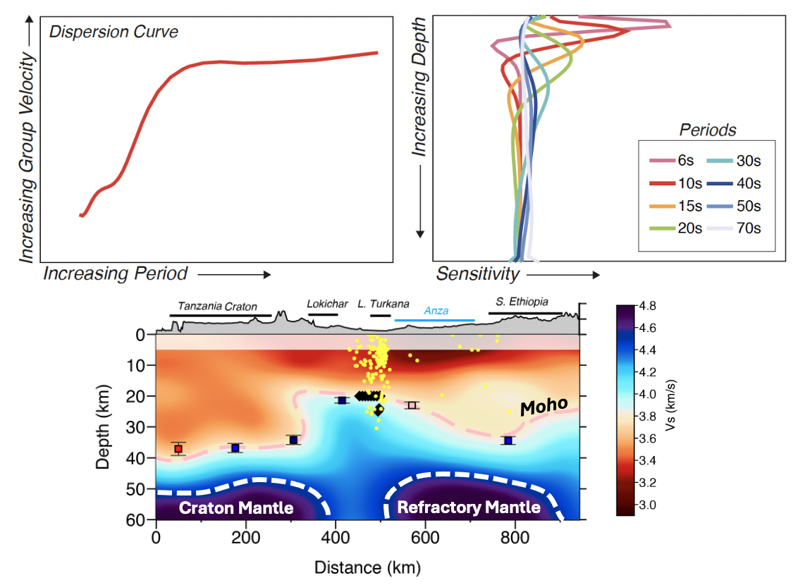
Surface-Wave Tomography
Surface-waves are high amplitude, low frequency, portions of a seismic wave that follow earthquake-station trajectories along the Earth’s surface, mainly sampling crustal and uppermost mantle depths. Surface-wave tomography exploits the dispersive nature of these seismic waves, whereby seismic wave velocity varies with frequency (with lower frequencies traveling faster as they sample deeper in the Earth) and builds three-dimensional velocity models of the crust and upper mantle. Surface-wave tomography provides coverage at depths too shallow to be constrained by body-waves.
Read More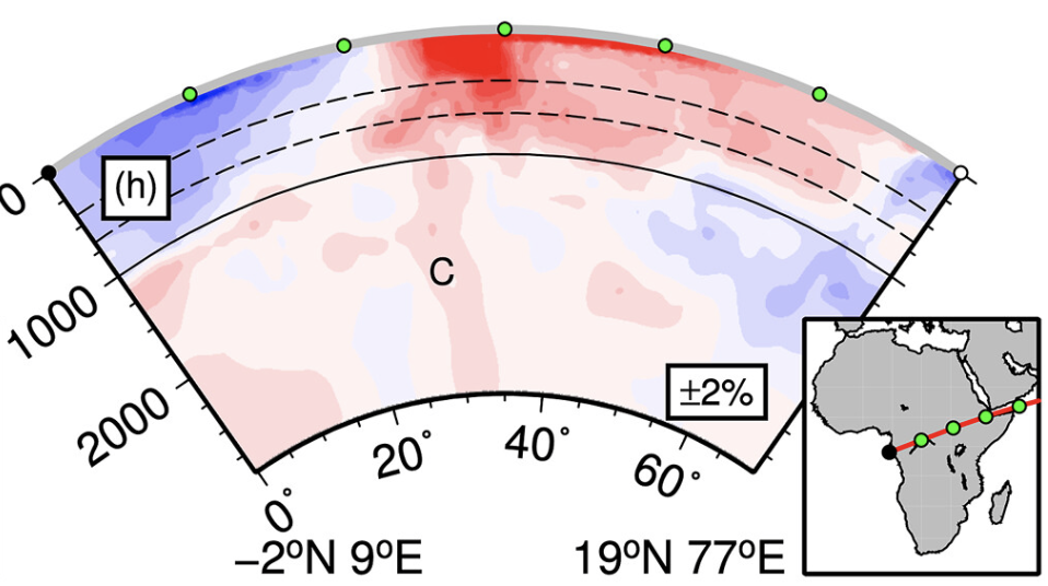
Absolute Arrival-Time Tomography
Absolute arrival-times allow us to more accurately assess the causes of seismic anomalies and make more meaningful comparisons with other study areas by benchmarking the residuals with respect to the global average arrival-time. Absolute first arrival times can be recovered by stacking cross-correlated and aligned waveforms across a seismic network and benchmarking against a reference model.
Read More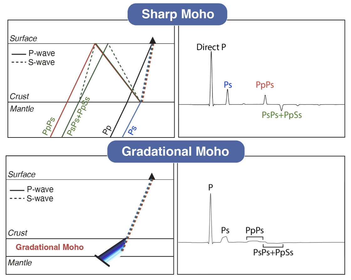
Receiver Functions
Receiver function analysis isolates seismic waves that are converted at subsurface boundaries, allowing us to image discontinuities within the crust and upper mantle. This method is widely used to determine crustal thickness, bulk-crustal Vp/Vs ratio, and depth of the lithosphere-asthenosphere boundary.
Read More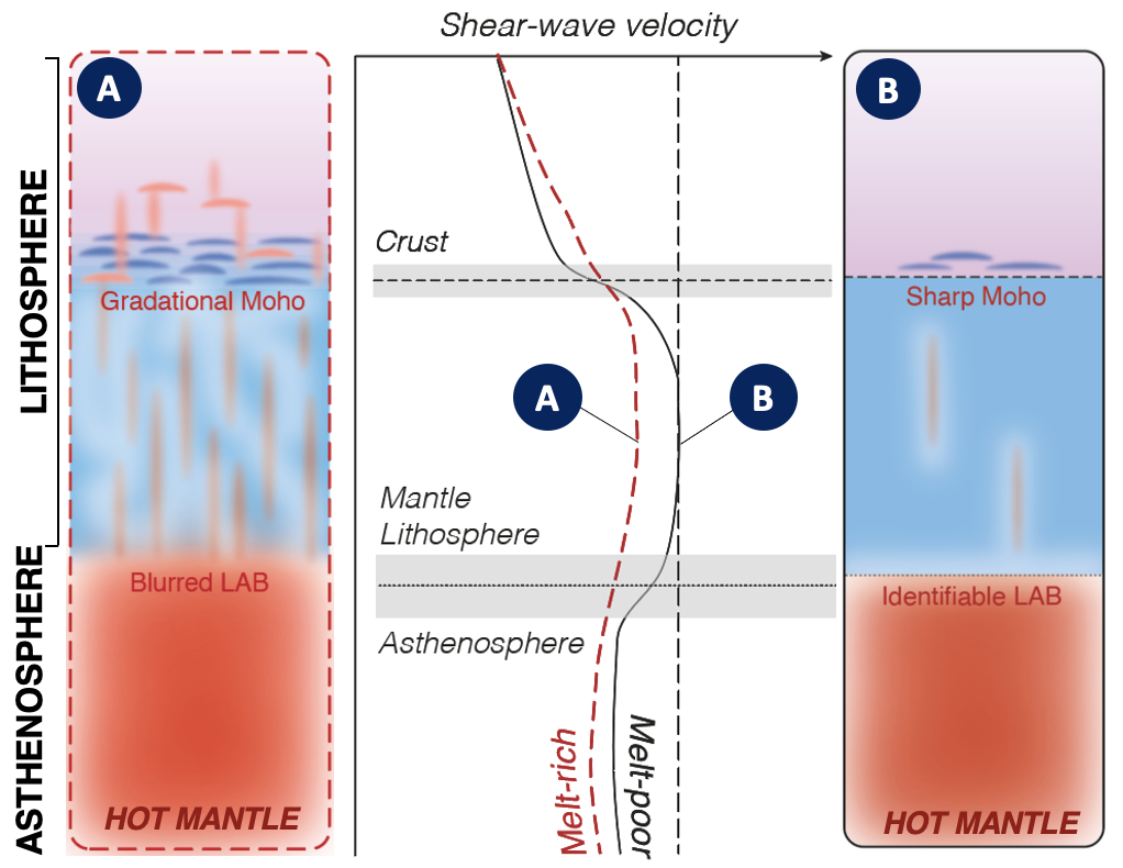
Joint Inversion
A joint inversion of complementary portions of the seismic wavefield, such as receiver functions and surface-waves, are a powerful tool for producing a detailed picture of velocity variation with depth at crustal and upper-mantle depths. Receiver functions are sensitive to sharp velocity contrasts but lack information on absolute velocities—constraints with are instead provided by surface-waves.
Read More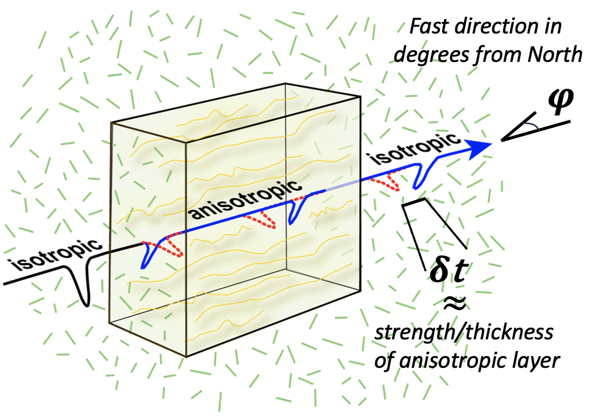
Shear-Wave Splitting
When a shear-wave traverses an anisotropic medium it splits into two orthogonally polarised waves, one travelling faster than the other. This directional dependence allows for the evaluation of seismic anisotropy. The alignment of olivine in the mantle, melt-inclusions, or fault and fracture networks in the crust/lithosphere all give rise to anisotropy. We can thus assess lithospheric deformation associated with both past and present tectonic events, revealing insights into the orientation, significance and depth extent of various phases of deformation.
Read More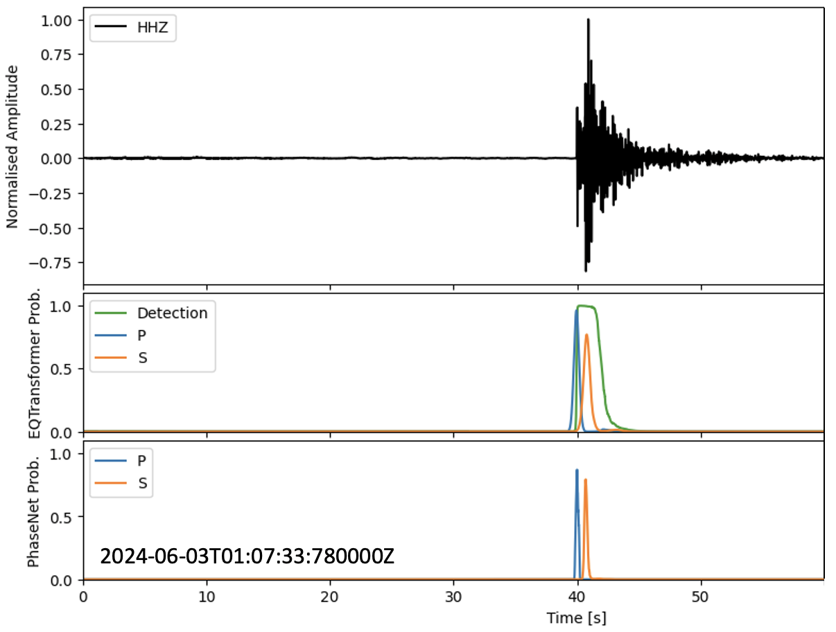
Earthquake Detection & Location
Seismicity contrains present-day deformation patterns and crustal strength, and identifies permeable pathways (i.e., faults and fractures) through which deep melts/fluids may be released to the surface. Continuous waveform data collected across Montserrat and Costa Rica are inspected both manually and using machine-learning based automated workflows for earthquake detections across the networks. The detected events are then located using probabilistic algorithms.
Read More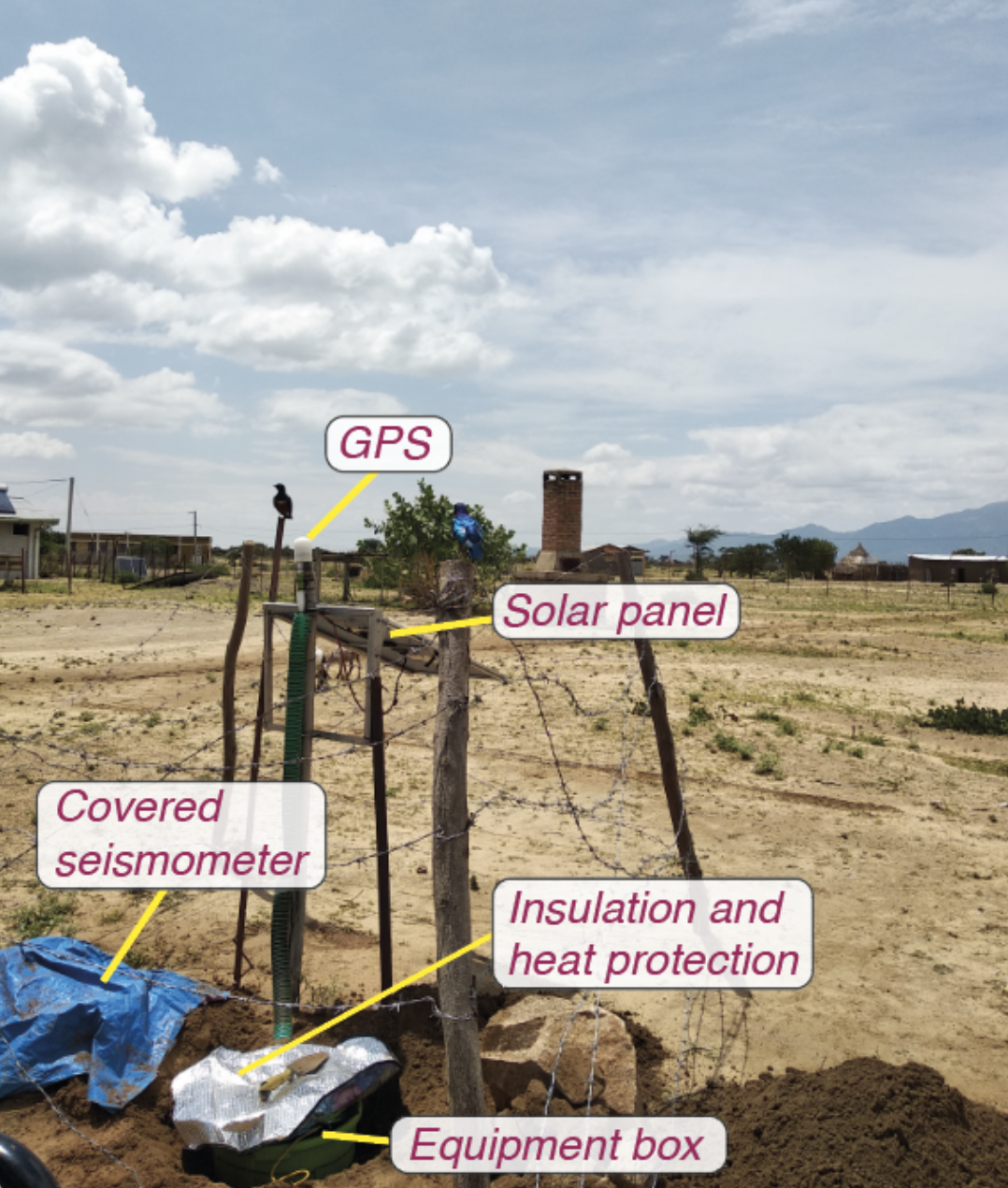
Field Deployments
Temporary deployments of seismograph stations are often a critical component of seismological research. These involve the installation of broadband instruments and dense nodal seismometers that can record both teleseismic earthquakes and local microseismicity. I have been involved in deployments in Cyprus, Zambia, Kenya, Ethiopia, and Montserrat spanning several tectonic settings: subduction zones, cratons, rifts, and volcanoes.
Read More